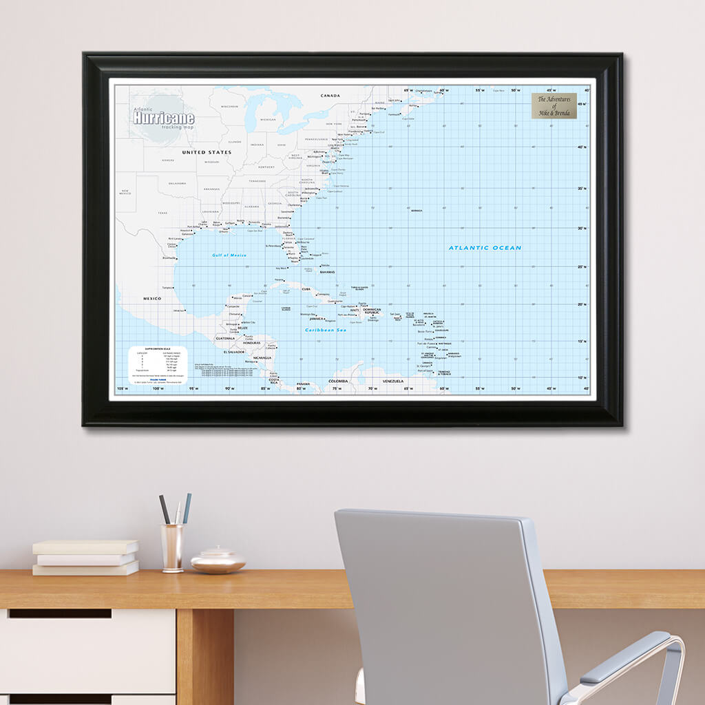

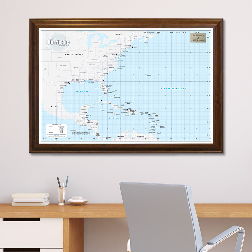
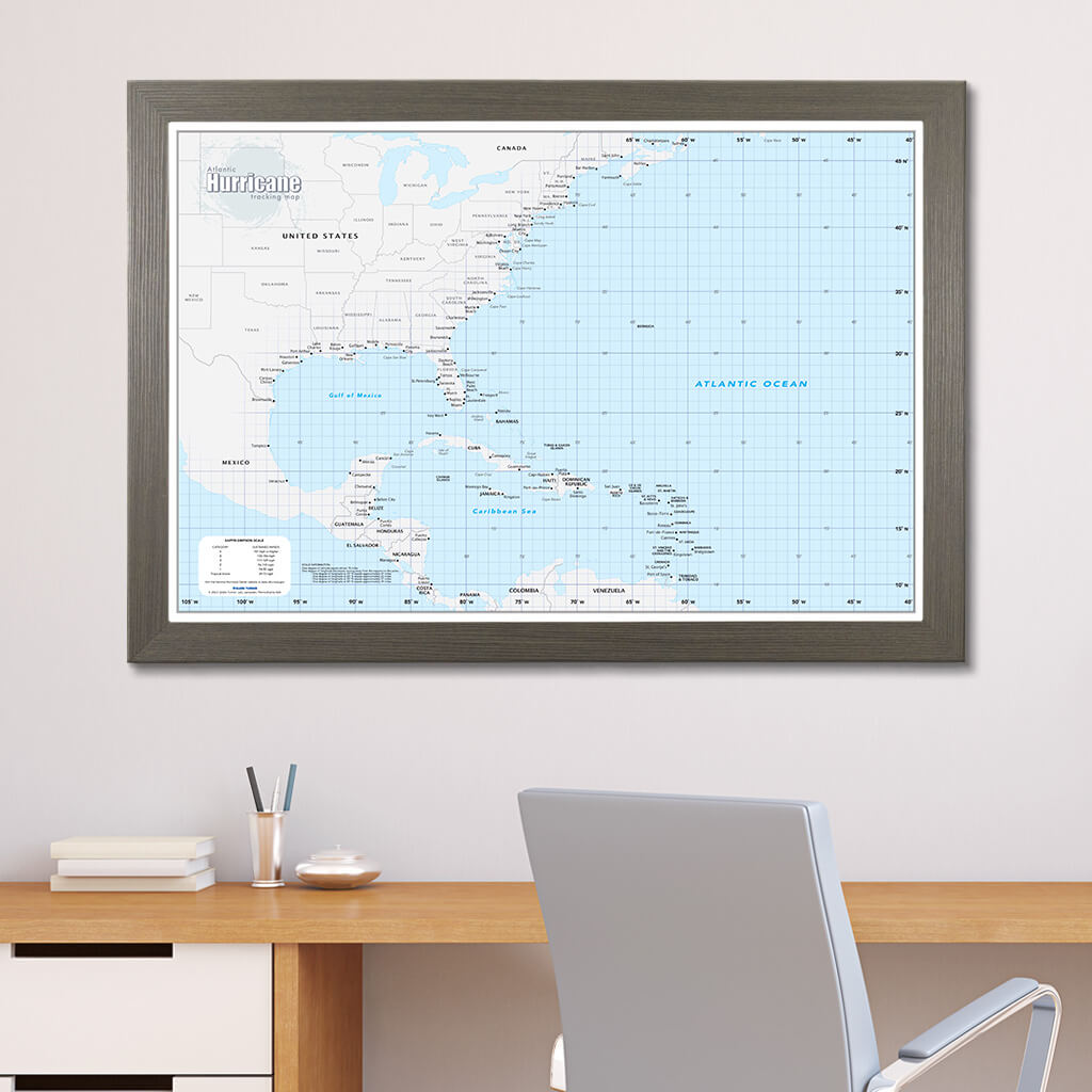
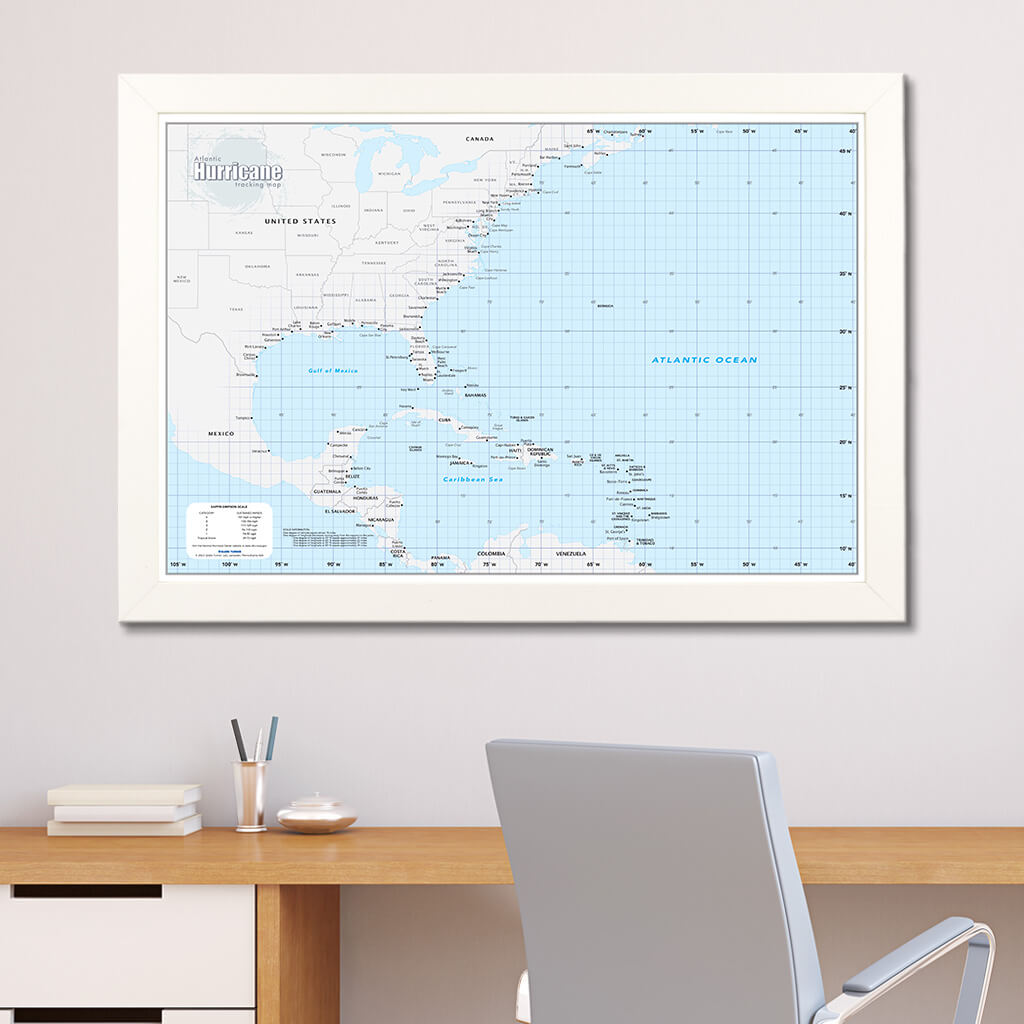
Atlantic Hurricane Tracking Wall Map with Pins

Pairs well with
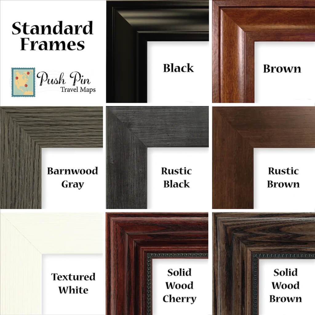
Product details
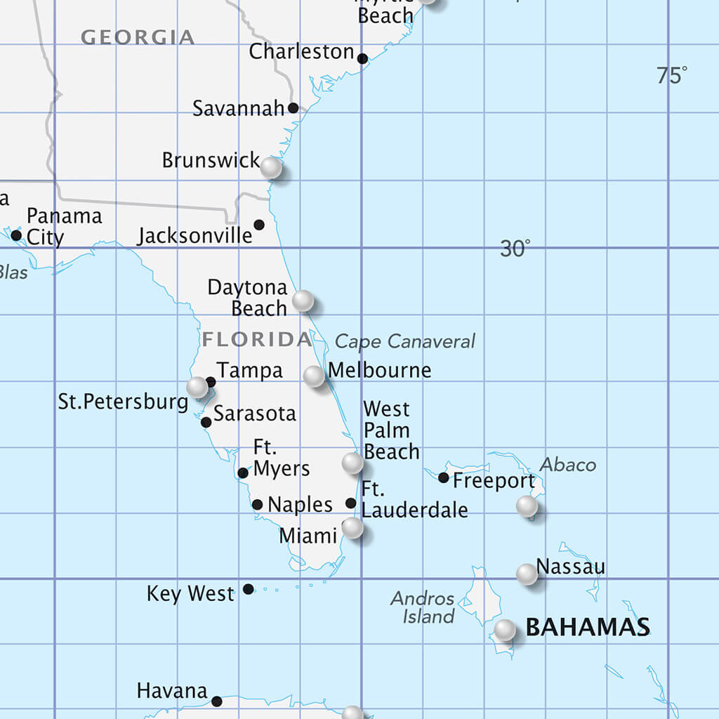
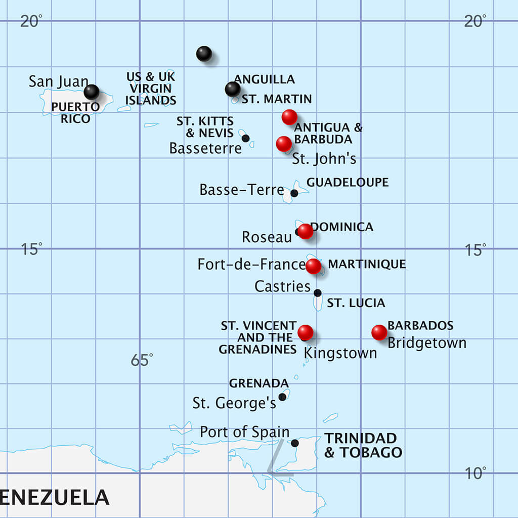
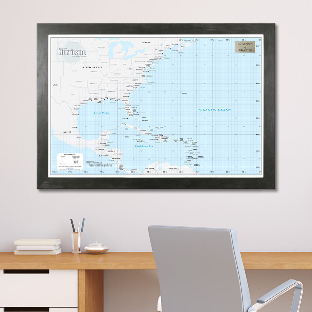
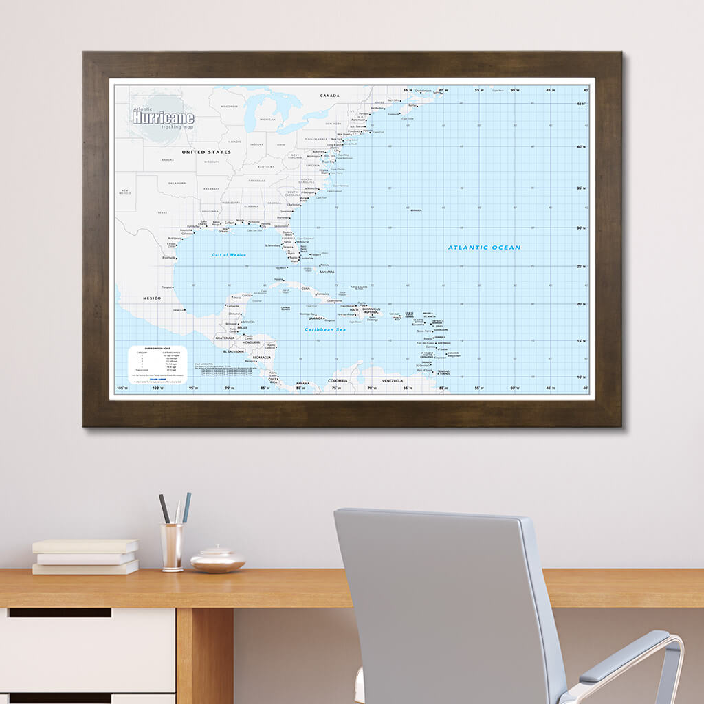
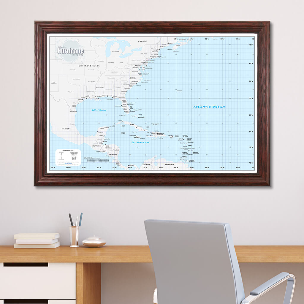
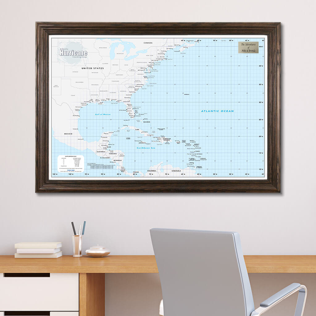
Stay on top of hurricane season with this Atlantic Hurricane Tracking Wall Map! This US and Caribbean Atlantic Hurricane Tracking Wall Map with Pins offers a detailed resource for plotting the course of hurricanes within portions of the Atlantic Basin. You'll be blown away by how easy the map is to use! Ideal for your home office, business, school, or governmental emergency planning agency, this map of the Gulf of Mexico, Caribbean Sea, and the central and western North Atlantic Ocean is divided into one degree latitude and longitude grid lines to make the tracking of tropical systems a breeze. Perfect for the curious enthusiast and weathered meteorologist to track storm systems in the Caribbean and along the Eastern Seaboard of the USA.
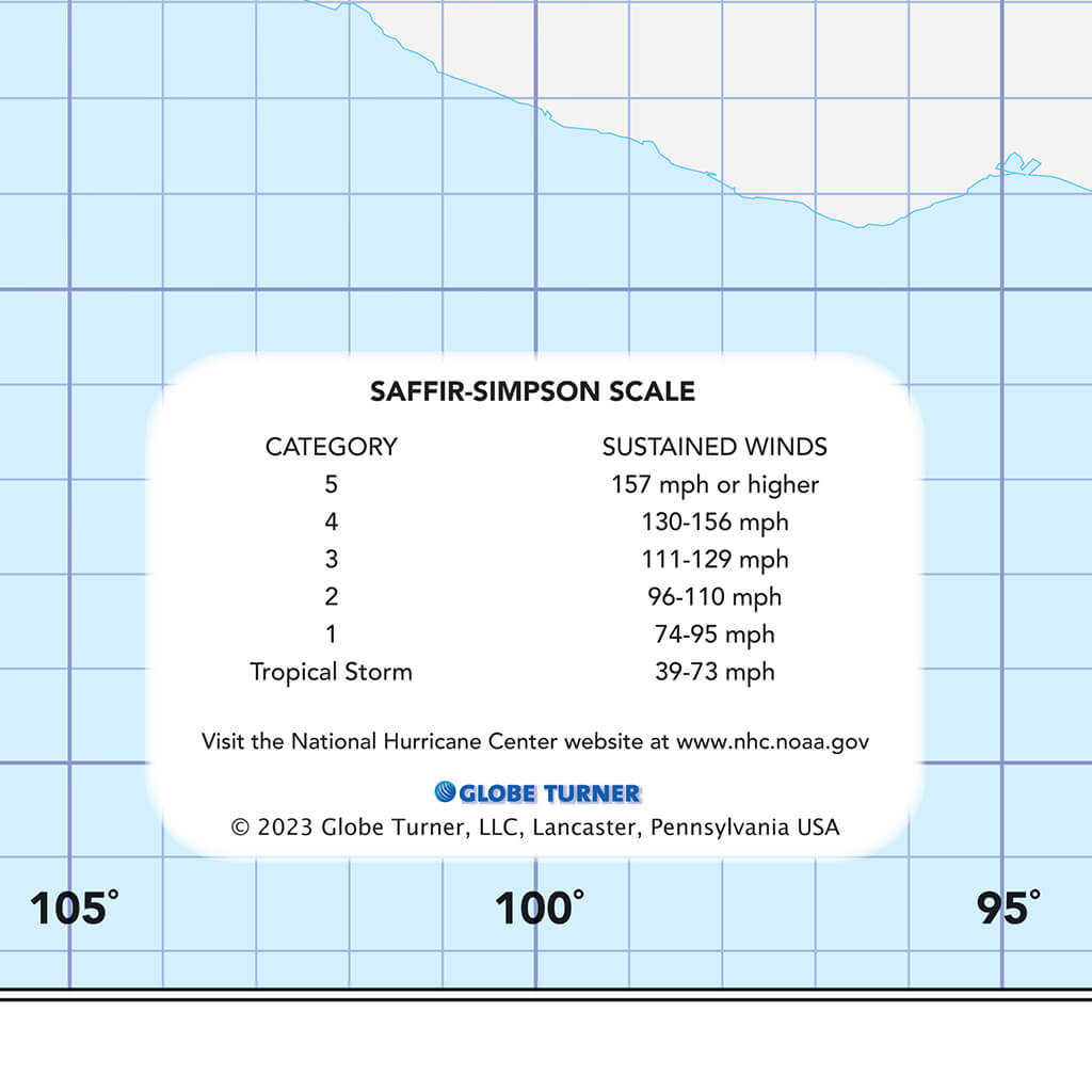
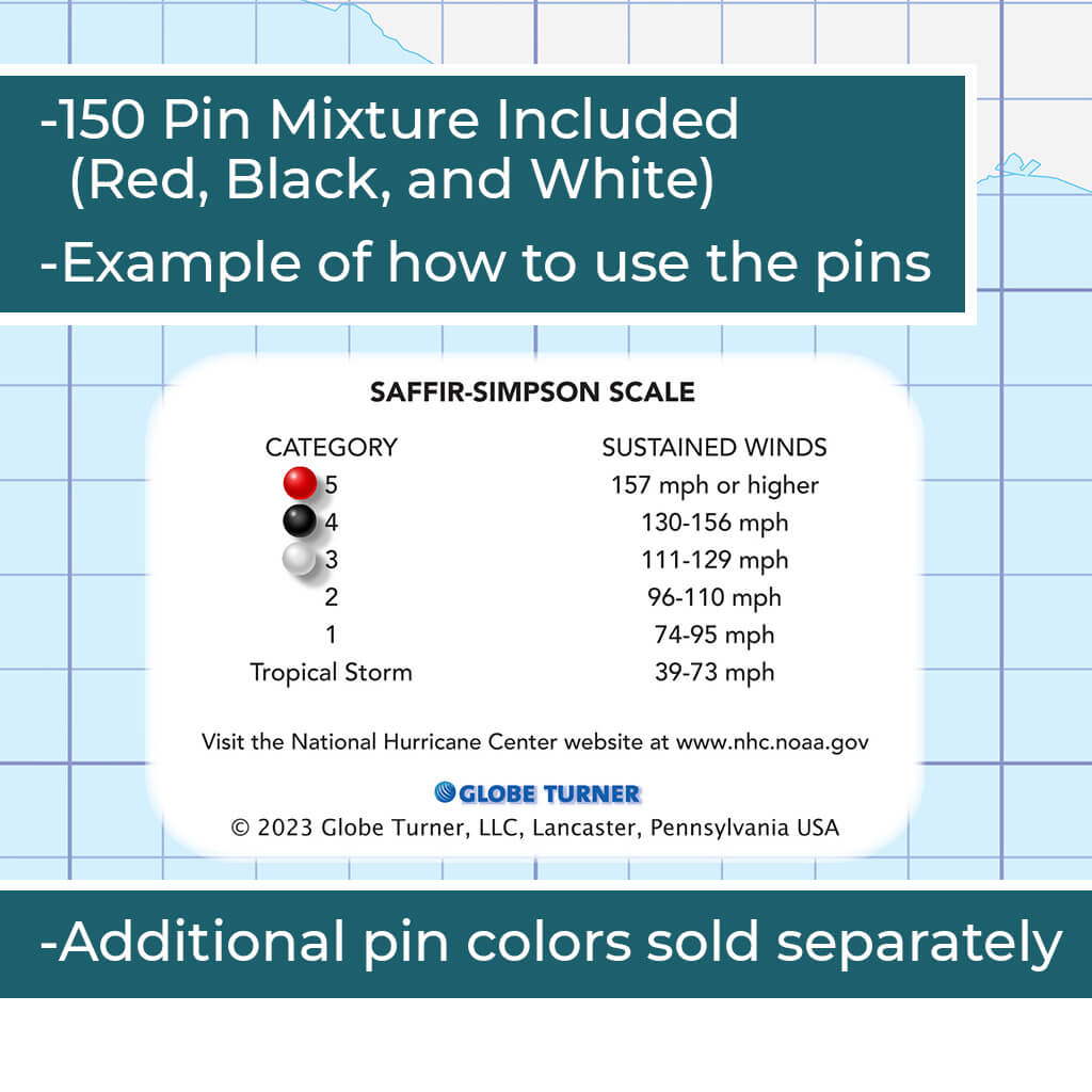
Durable and easy to read with large font sizes the map also includes push pins to track weather systems and keep your eyes on the storm. In the lower left of the map is a Saffir-Simpson Hurricane Wind Scale showing the wind mph and storm category designation. You can use the included pins to pin next to the scale as a map key, or however you choose! Add the custom personalization to make a one of a kind gift for the seasoned family hobbyist!
Framed dimensions are 27.5" H x 39.5" W / ~70 cm H x 100 cm W
What's in the Box?
Everything you need!
- Your stunning, ready-to-hang Push Pin Travel Map
- 150 Pins in a mixture of red, white and black
- Nail and hanger (all you need is a hammer!)
Map Dimensions
How Its Made!
Every Push Pin Travel Map is handcrafted in The United States of America (Denver, CO to be exact!). We take great pride in every map we produce. We start by professionally dry mounting your map to sturdy foamcore board. Our framing experts then place the map in the stylish frame of your choice, which we build in house. Next a wire hanging kit is installed, so your map arrives ready to hang right out of the box. We even include a nail and hanger so you can easily hang your map on the wall. Find out more details as well as answers to popular questions in ourFAQ section here.
Difference Between Paper and Canvas...
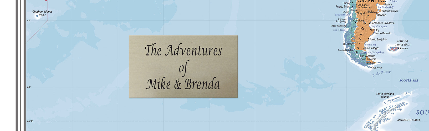
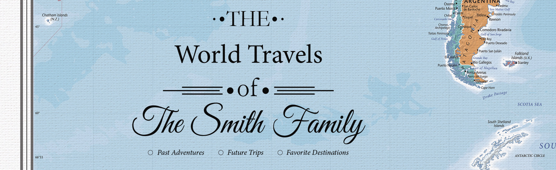
Our Paper Maps can be personalized with a metal plaque that is affixed to the map. Our Framed Canvas Maps, Gallery Wrapped Maps, Large 3 Panel Maps and Canvas Posterswill have your personalization printed directly on the map itself, using one of our 9 unique personalization templates.
Additionally, our paper maps have a smooth finish and our canvas maps have a textured look and feel. Both paper and canvas maps are mounted to foamcore board, which is what holds the pins in place. Both versions are high quality and will last you a very long time. Basically, it comes down to a matter of personal preference!
Paper
Canvas
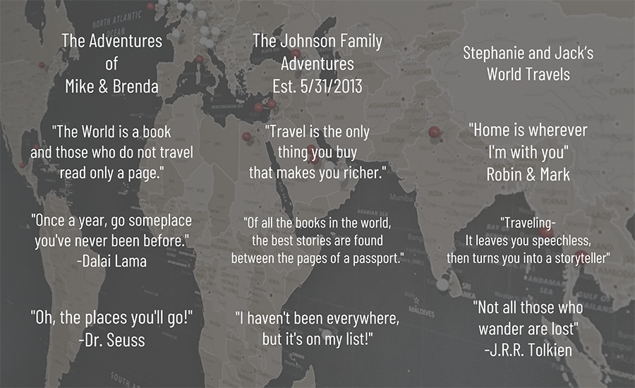
Personalize Your Map
Want to add a unique touch to your Push Pin Travel Map? Personalize it for FREE! Choose from our most popular sayings and quotes or create your own. Customize your plaque with up to 3 lines of text and a maximum of 30 characters per line.


Free Shipping
Ground shipping is free on all contiguous US orders over $100. Need your order right away? Choose one of our Express shipping options at checkout.
Fast Processing
All our products are handmade to order and shipped as quickly as possible. Check out our FAQ for current processing times.
Amazing Customer Service
Customer service so good, it's like having your own personal genie. Ask us anything and watch the magic happen!
If you have any questions, you are always welcome to contact us. We'll get back to you as soon as possible, within 24 hours on weekdays.
Shipping Information
All of our travel maps and travel themed products are handmade to order, right here in the USA. Therefore, it may take 1 to 3 business days to process your order and get it shipped out to you. Transit time is usually 1 to 5 business days depending on your location.
Customer Support
Use this text to answer questions in as much detail as possible for your customers.
Need some extra help? Send us a message and we will get back to you as quickly as possible.